How mixed reality is transforming city and urban planning
Simulating your neighborhood before you break ground will have everybody talking – and ultimately save you money
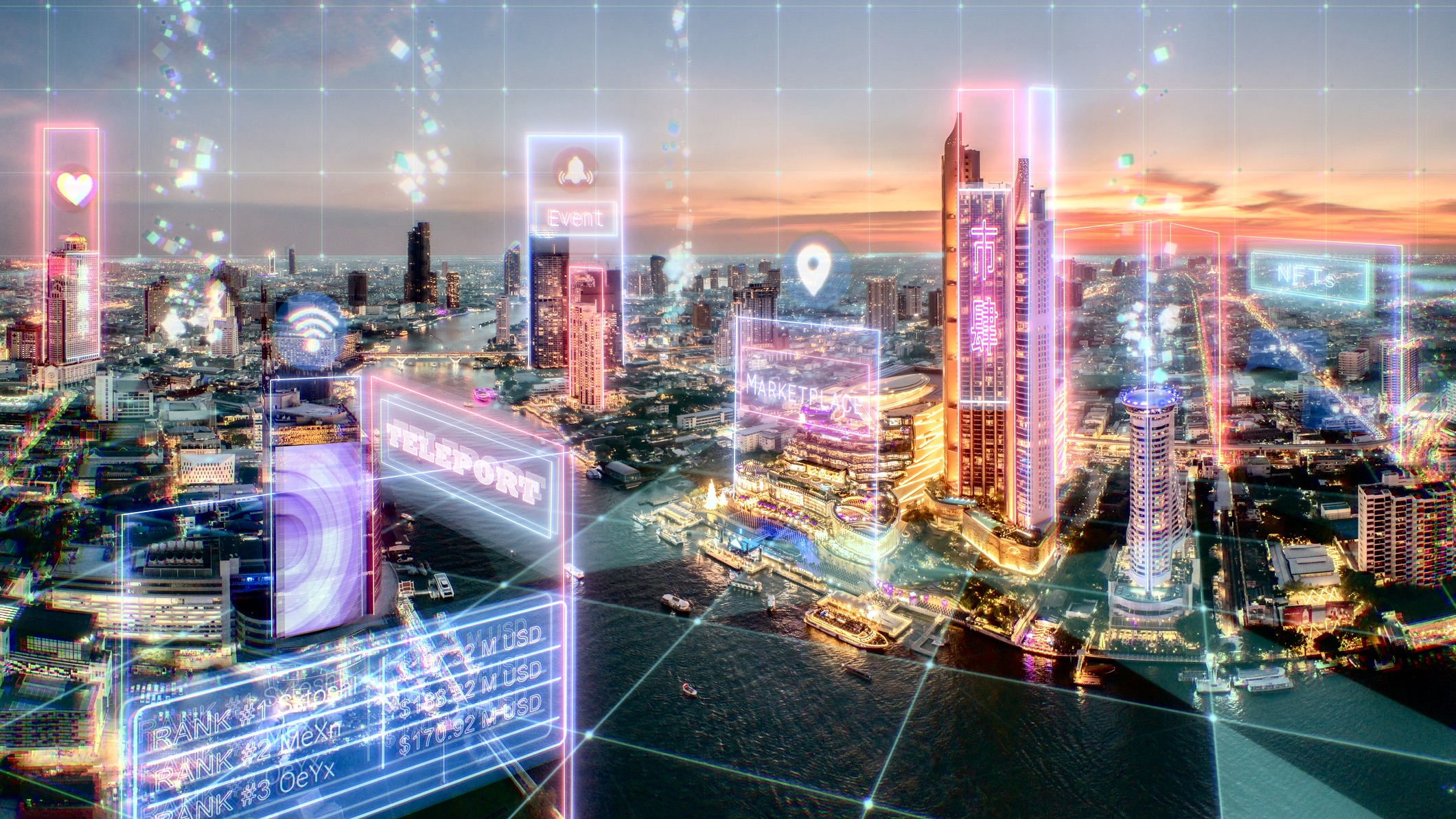

If you've experienced virtual reality (VR) using a Meta Quest or HTC Vive you'll know it's great for Beat Saber, but did you know it's finding a dedicated user base in urban planning?
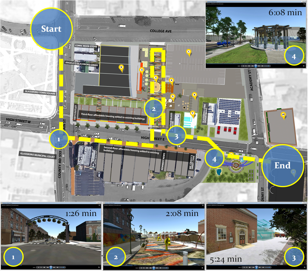
In Bochum, Germany, Ruhr University cartographers used VR to investigate the impact of proposed traffic flow changes on residents. In Glassboro, New Jersey, the Rowan University Community Planning + Visualization Lab built a VR reimagining of the city's downtown so residents could comment on how best to redevelop the area.
Exploring and moving through virtual environments is perfect for showcasing proposed changes to buildings or neighborhoods, and altering the shape or size of elements or the way people and systems use the space gives every stakeholder the means to weigh in.
The business case for VR in city planning
In the German study, residents got to experience the new traffic throughput system before any disruptive changes were made in real life. The New Jersey team found community participation increased exponentially. For many, the business case is obvious.
In every case you care to mention, participant engagement is off the charts. A more immersive experience gives everyone a clearer understanding of the issues in question and lets users provide immediate, real-time feedback.
But VR has a measurable financial impact too, even if it's only in development time. "The immediacy of real-time changes reduces the back-and-forth we typically experience," says Kat Campbell, a data scientist who builds VR experiences. "People grasp spatial designs faster and they're able to articulate changes more precisely."
Those savings can be made across the process. Sometimes it's simply because walking through a plan in 3D is more intuitive than looking at paper sketches. Sometimes it's because visualizations for power providers, residents, or traffic management exist in the same environment without needing a new representation of the design that applies only to them.
Get the ITPro daily newsletter
Sign up today and you will receive a free copy of our Future Focus 2025 report - the leading guidance on AI, cybersecurity and other IT challenges as per 700+ senior executives

Devin Lavigne says using VR has 'dramatically' reduced the time spent converting 2D plans into 3D models at Houseal Lavigne, the Chicago architecture, construction and design firm where he's a partner. The company recently used VR to model two possible scenarios for the city center of Morrisville, North Carolina. Using a product called ArcGIS CityEngine from mapping and geospatial analytics provider Esri, the VR experience let city decision-makers compare building heights, tree placements, and other variables.
"Fewer internal team revisions and meetings are needed, streamlining the decision-making process," Lavigne says, adding that the Morrisville project was delivered in less than a month – far shorter than traditional approaches using spreadsheets and concept drawings.
Savings can also be made in project sharing – when they're cloud-based or remotely hosted, VR experiences are more accessible. As Shanal Aggarwal, chief commercial officer at digital transformation provider TechAhead, says: "We can collaborate without hindrance from a distance."
Then there's the means to correct problems before they cost real money. It wasn't until Edmonton, Alberta-based urban design firm Stantec deployed one public space redevelopment in VR that anybody realized a rest area faced directly onto a busy street – traditional tools hadn't revealed an area of sloped ground that caused the issue. Campbell also remembers a downtown redevelopment where planners realized the positioning of a bus stop wouldn't work, a mistake she says would have run into “hundreds of thousands'” to correct if they'd actually built it.
How to bring VR into urban planning projects
Just like writing a bestseller or programming the next killer app, if it was easy everyone would be doing it. VR is hard, and in the short term, it's more expensive than plans and elevations. But assuming it will save money in the long run, how do you do it?
At its most basic, VR is the representation of data in a software framework – the game engine. Game engines like Unreal or Unity are platforms containing graphics rendering (refreshing the scene when the viewer changes angle or direction) control over how objects behave according to physics, soundtracks, elements created and positioned by AI, memory and data streaming management, and more.
But where a videogame puts designed characters, environments, and behaviors into a game engine, VR takes information from the outside world.
To reimagine downtown Glassboro, the Rowan University team started with satellite images, added models of existing buildings from Google Earth, and created new buildings with SketchUp. In other cases, elements are imported directly from CAD models.

But VR can also contain visualizations of non-visual information. "[Other data sources] are typically considered as overlays present on top of 3D elements in the virtual environments to provide visual feedback that represents a specific dataset like colored paths, heatmaps, and so on," says Dr Michael Mortimer of Deakin University's CADET Virtual Reality Training and Simulation Research Lab.
In Houseal Lavigne's Morrisville project, changes to the environment were made on the fly by social media comments. A current port project incorporates live data feeds from nautical traffic systems. The means to integrate live data streams are nearly endless.
"Almost any data can be integrated – the challenge is how to represent it to make sense for humans," adds Todd Richmond IEEE member and director, Tech + Narrative Lab, Pardee RAND Graduate School.
A building information model (BIM) might have sensors providing information on temperature or foot traffic, but other data are harder to present visually; one example Richmond mentions is biometric data to track user sentiment. "Some of it's still sci-fi, but less than you might think. The data's there, but the analysis and visualization is still a work in progress."
Where do we stand on VR?
At Rowan University, associate professor of planning of the Department of Geography, Planning, and Sustainability Dr Mahbubur Meenar says few urban planners have experience with VR simulations. Even setting up the necessary infrastructure in planning offices can be challenging, much less teaching people how to use it.
He also takes pains to add it doesn't suit every project. "All communities are unique, and when we design an engagement activity we study the community in question. If the development impacts older adults who aren't comfortable with immersive VR experiences, for instance, you may not get the desired result."
Richmond adds the infrastructure to deliver VR to begin with is a potential stumbling block. "5G helps but has limited roll-out, but more importantly, there aren't enough inexpensive hardware options for widespread adoption."
And even if there were, repurposing a VR experience for a handheld device – which is more in the realm of augmented reality (AR) – rather than a fully kitted VR experience might just mean scrimping on the features that make VR compelling in the first place.
RELATED RESOURCE
Virtual reality for work: The ultimate guide
Discover how leading companies are using VR to overcome their business challenges
DOWNLOAD NOW
"With enough bandwidth and devices, anything is scalable," Richmond continues. "Interactions is the hard part – what affordances do you provide for users who are fully immersed versus those participating through a limited onramp?"
Of course, every tech company worth its salt is developing its own metaverse right now, where VR will have a natural home. But – assuming it's even cheaper to use one of them rather than build your own – the industry is inthe very early stages, and as the backers of Betamax, MySpace and Blackberry well know, the wrong bet can cost city planning stakeholders dearly.

"Ideally the metaverse will follow the internet model of being agnostic with on-ramps and technologies all working in a subset of standards," Richmond says, "but there is a risk of competing standards."
Whatever the technological and cultural hurdles, VR in city planning seems almost ordained. As a blog post from Edmonton design firm Stantec says; 'If a picture is worth a thousand words, then VR is worth a million'.

Drew Turney is a freelance journalist who has been working in the industry for more than 25 years. He has written on a range of topics including technology, film, science, and publishing.
At ITPro, Drew has written on the topics of smart manufacturing, cyber security certifications, computing degrees, data analytics, and mixed reality technologies.
Since 1995, Drew has written for publications including MacWorld, PCMag, io9, Variety, Empire, GQ, and the Daily Telegraph. In all, he has contributed to more than 150 titles. He is an experienced interviewer, features writer, and media reviewer with a strong background in scientific knowledge.
-
 Cleo attack victim list grows as Hertz confirms customer data stolen
News Hertz has confirmed it suffered a data breach as a result of the Cleo zero-day vulnerability in late 2024, with the car rental giant warning that customer data was stolen.
By Ross Kelly
-
 Lateral moves in tech: Why leaders should support employee mobility
In-depth Encouraging staff to switch roles can have long-term benefits for skills in the tech sector
By Keri Allan